 geocatalogue.geoportail.lu
Administration du Cadastre et de la Topographie
Type of resources
Available actions
Topics
Keywords
Contact for the resource
Provided by
Groups
Years
Formats
Representation types
Update frequencies
status
Service types
Scale
-

This layer contains the public administrations situated in the nature parc Our
-

3D buildings with LOD 2.3 classification resulting from a proof of concept of 2017. The buildings are modelled based on a photogrammetric evaluation of aerial images from 2017 and are only available on a total area of 3 km2 in Diekirch and Bastendorf.
-
3D model of the Luxembourg terrain based on vertical and oblique aerial images from summer 2020.
-
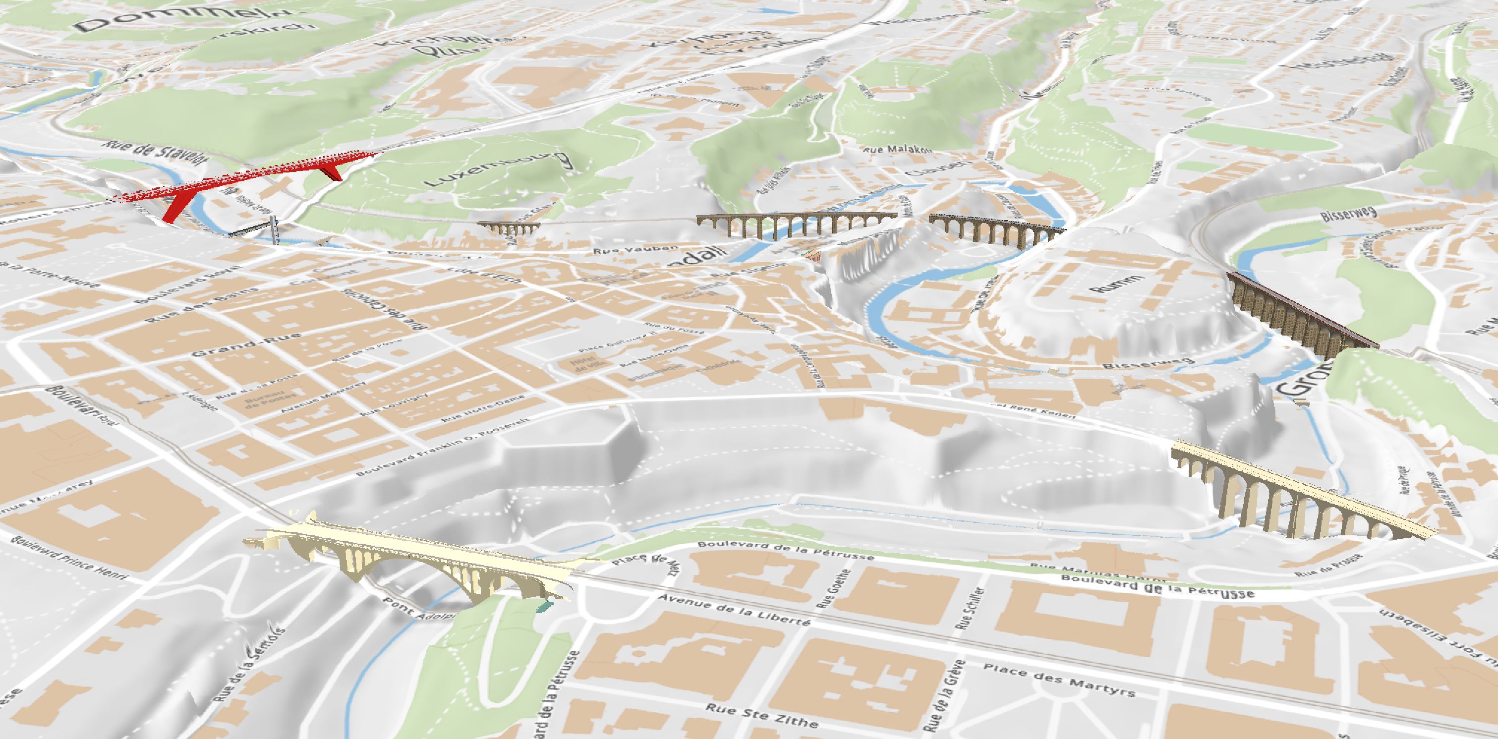
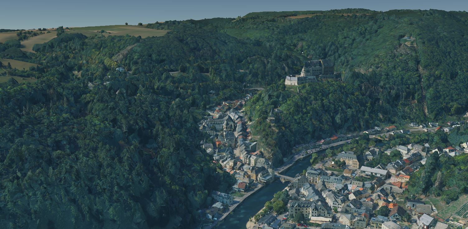
3D models with LOD 3 classification of a selection of remarkable bridges. The 3D models were created partly by the Administration du Cadastre et de la Topographie and partly by the Service Topographie et géomatique of Luxembourg City.
-
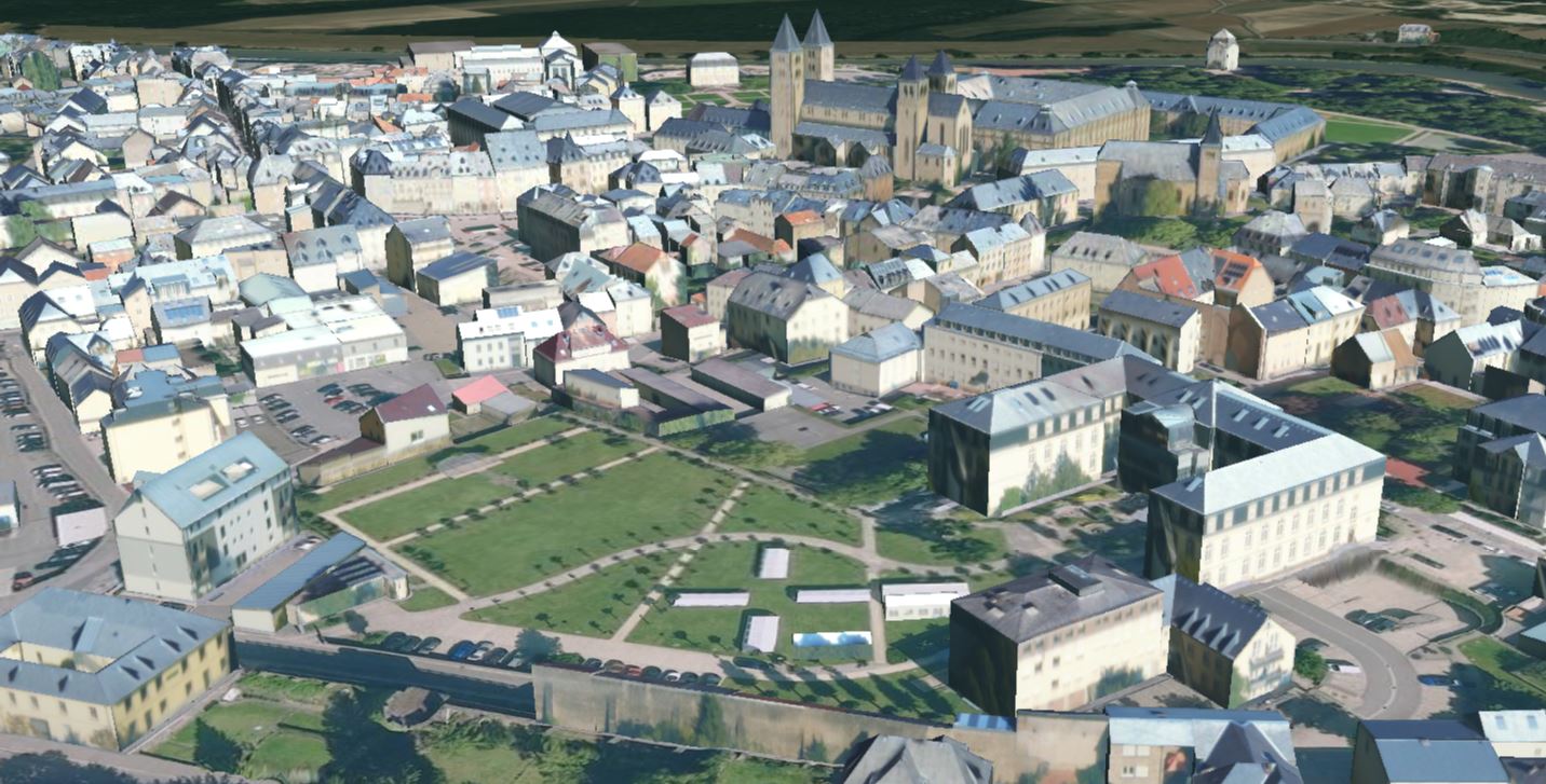
3D buildings with LOD 2.2 classification on the national territory of the Grand Duchy of Luxembourg in 2020, with the exception of the municipal territory of Luxembourg City. The 3D buildings were created on the basis of aerial images from summer 2020 (flight period: end of July, beginning of August and mid-September 2020; flight height: +/- 3500 m above ground level) by photogrammetric restitution of the roofs (MSE in x, y and z ≤ 20 cm), followed by downward extrusion and texturing of the resulting 3D models of the buildings with oblique aerial images. Only the roofs of buildings with a footprint greater than 20 m2 were captured, taking into account superstructures (e.g. dormers) whose longest side exceeds 50 cm and which have a volume greater than 1 m3.
-
3D models with LOD 1 classification of the bridges on the national territory of the Grand Duchy of Luxembourg in 2019. The 3D models were automatically extracted from the point cloud of the LiDAR survey in February 2019.
-

The hybrid map uses the most recent aerial image as background. In addition, it contains roads, street names and locality names.
-
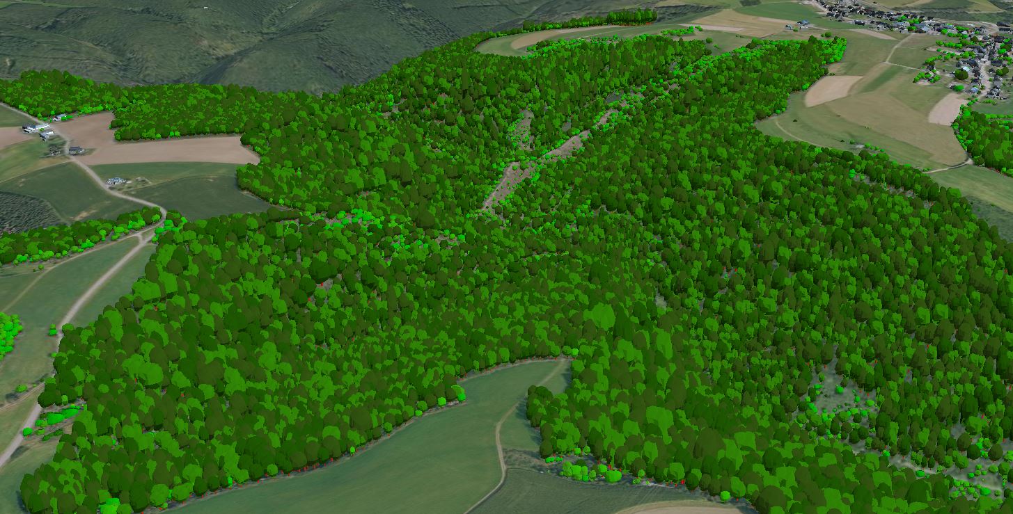
3D models of trees on the national territory of the Grand Duchy of Luxembourg, derived from the point cloud of the LiDAR survey in February 2019. The models do not correspond to the actual shape or type of the trees, but consist of a generalised model that has been scaled according to the tree parameters extracted from the point cloud.
-

A topographic map is intended to be a representation of the terrain. It differs from thematic maps (city maps, road maps etc.) by the richness of its content, its high precision and above all the representation of the topography by the contour lines. The cadastre and topography administration publishes topographic maps at the scales of 1:5,000, 1:20,000, 1:50,000, 1:100,000 and 1:250,000.
-
The road map is a multi-scale digital map that contains transport networks, buildings, vegetation and hydrology. It is updated monthly and the new roads are entered at the same time as the changes on the cadastral plan. The road map uses vector tile technology, which gives you new possibilities to display the road map. The style editor gives you the choice between 3 editing modes: - Choose a predefined style: This editing mode provides you with a list of predefined colour palettes, which you can use to colour the map. - Modify the main colors: In this mode you can select an individual colour by theme. You also have the option of activating or deactivating a theme by checking the box. Advanced possibilities: This mode allows you to adapt the style of your map without restrictions. Using the Maputnik external style editor (https://maputnik.github.io/), you can make all kinds of modifications. When you are done editing, you can upload your style. The settings remain stored in your browser. When you are logged in, they are loaded into your profile so that they can be reused on another computer. Of course, the settings can also be used to create a custom background map and integrate it into your own website.